
Lake Powell level climbs 7.1 feet after heavy rain
Water levels rose to 3,526.1 feet above sea level, a gain of roughly 600,000 acre-feet that officials describe as a welcome start to the new water year.
By Cole Anderson ·
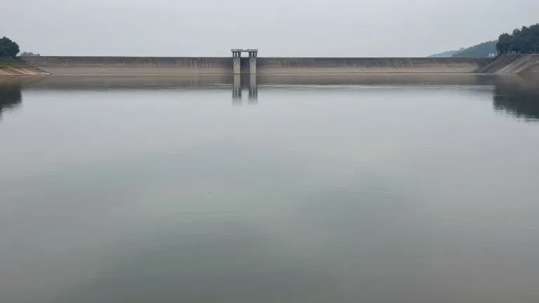
Heavy rainfall across the Four Corners region of Utah, Colorado, and New Mexico over the past week has resulted in a substantial increase in the water level of Lake Powell. Saturday’s daily measurement recorded the lake at 3,526.1 feet above sea level. This figure represents a rise of 1.1 feet from the previous day’s reading and 7.1 feet above the level recorded two weeks ago, according to the Lake Powell Water Database.
Gene Shawcroft, chair of the Colorado River Authority of Utah, described the increase as phenomenal for this time of year. He estimated that the rise, which he expects to reach 10 feet once Sunday’s measurements are completed, adds approximately 600,000 acre-feet of water to the reservoir. Shawcroft noted that this volume is equivalent to twice the capacity of Jordanelle Reservoir.
The lake had been approaching critically low elevations before the recent storms. Shawcroft stated that the 10-foot gain makes a significant difference, though he cautioned that it does not solve the underlying storage problem. The lake’s lowest point this year occurred on Sept. 15, when it was 180 feet below its full capacity. A lake at full capacity has not occurred since 1983.
Paul Miller, a service coordination hydrologist for the National Weather Service’s Colorado Basin River Forecast Center, characterized the 9.5-foot rise above the September low as a drop in the bucket. However, he called it good news and a nice start to the water year, which began on Oct. 1 and runs through Sept. 30, 2027.
The recent rain has not produced a similar rise in Lake Mead, the downstream reservoir. Because most of the precipitation fell upstream of Glen Canyon Dam, Lake Mead’s water level has increased by only 0.06 feet in the last two weeks, according to its measurement database.
While the lake levels rise, the San Juan River has caused flooding in the region. On Sunday, the Navajo Department of Emergency Management reported that rising waters prompted evacuations and road closures in three towns within the Navajo Nation: Bluff, Montezuma Creek, and Aneth. The National Weather Service in Grand Junction, Colorado, declared catastrophic flooding along the river between Four Corners and Mexican Hat.
A flood watch remained in place for the Bluff area through Sunday evening, with a flood warning in effect through Tuesday morning. Miller indicated that the water causing these flood conditions will not reach Lake Powell until late Sunday evening or early Monday morning. Consequently, the lake’s levels are likely to increase further.
The San Juan River is currently contributing a higher share of inflow than typical. In September, the river was contributing about 105% of its average amount of water. In October, that figure has risen to approximately 251% of the average. Miller noted that about one-third of the water flowing into Lake Powell this month has come from the San Juan River, a share well above the 13% the river usually contributes in October.
Overall, inflow into Lake Powell in October stands at 152% of the monthly average. In contrast, the Green River Basin is contributing water at typical October levels. The upper Colorado headwaters are producing about 64% of their usual October volume.
Source: The Salt Lake Tribune · original report published
More News · Salt Lake City news · Report a business · Got a Story?